Harvester Relays
Overnight orienteering relay
Blakeholme, Lake District
Saturday 24 - Sunday 25 June 2017
The UK's answer to the famous Jukola relay
On the night of Saturday 24 - Sunday 25 June 2017, DrongO presents the 39th Havester relays, a 7 or 5 person overnight orienteering relay.
Exciting Lake District terrain
We will be using Blakeholme, runnable deciduous woodland with a wealth of contour detail.
A mixture of night and day legs
About 3 or 4 of the 5 or 7 runners in each team will be running in the dark/twilight, and the rest in the day.
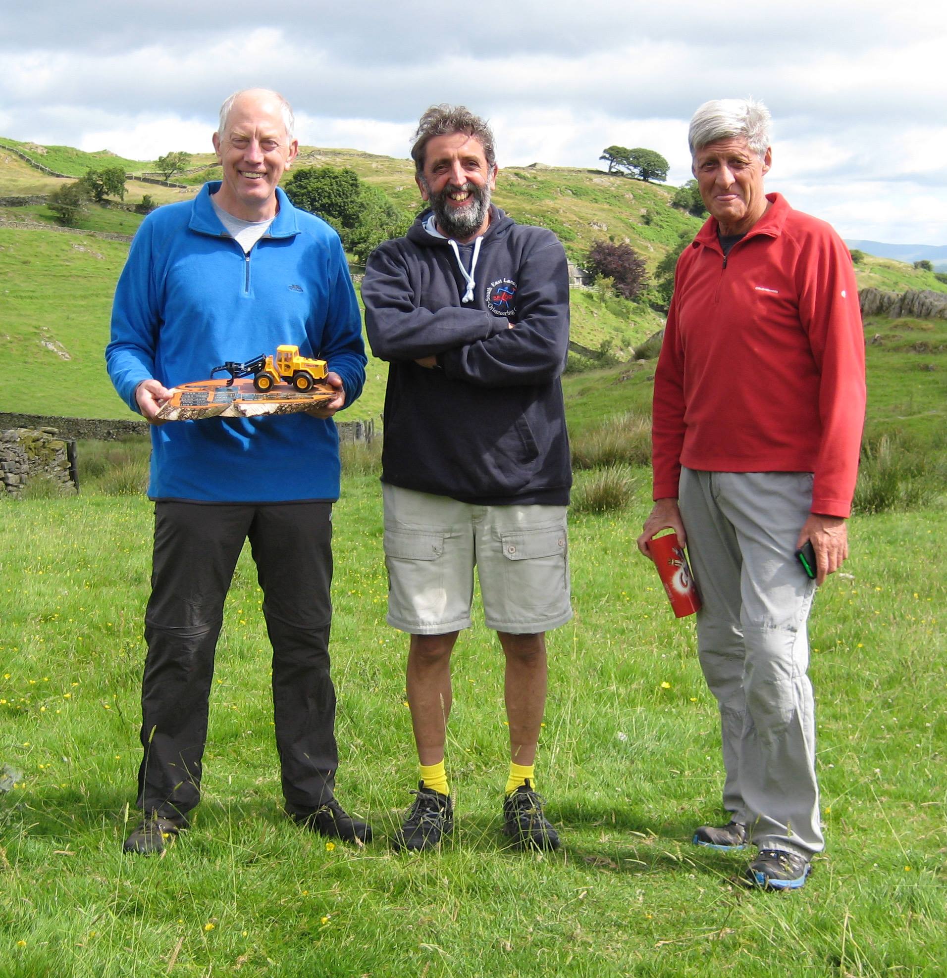
Trophies/Prizes
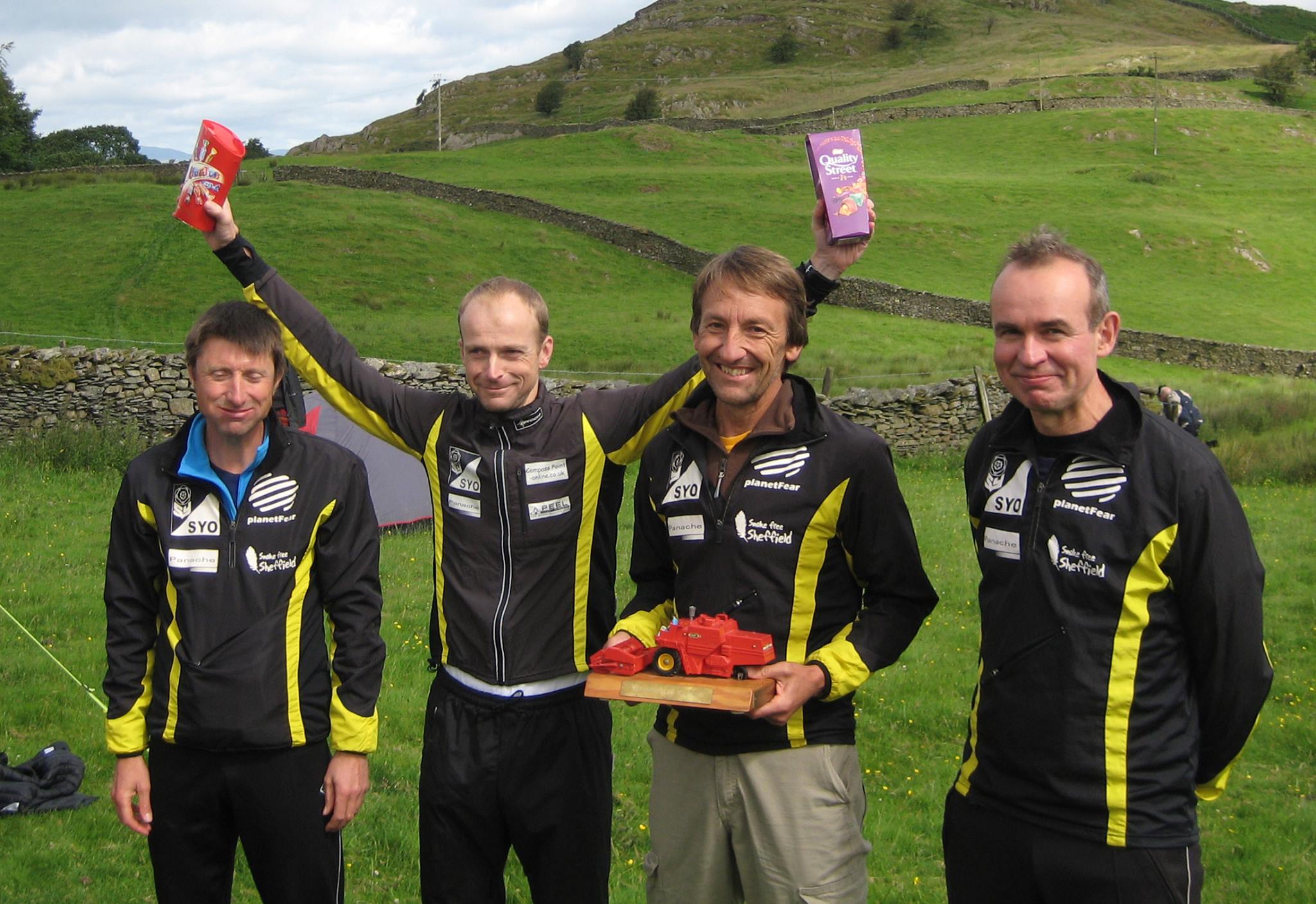
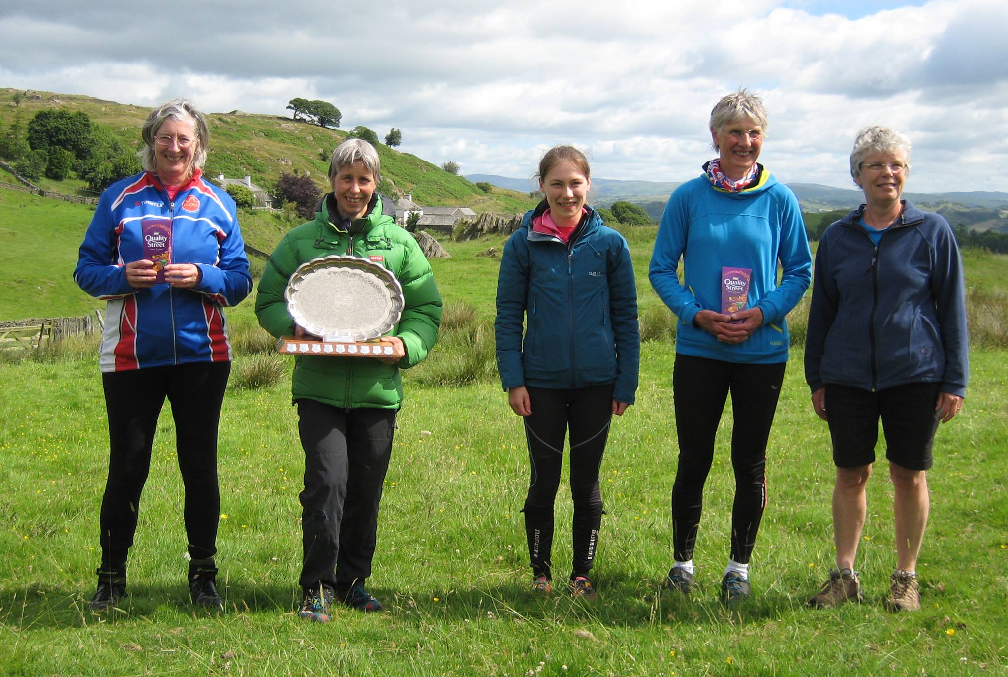
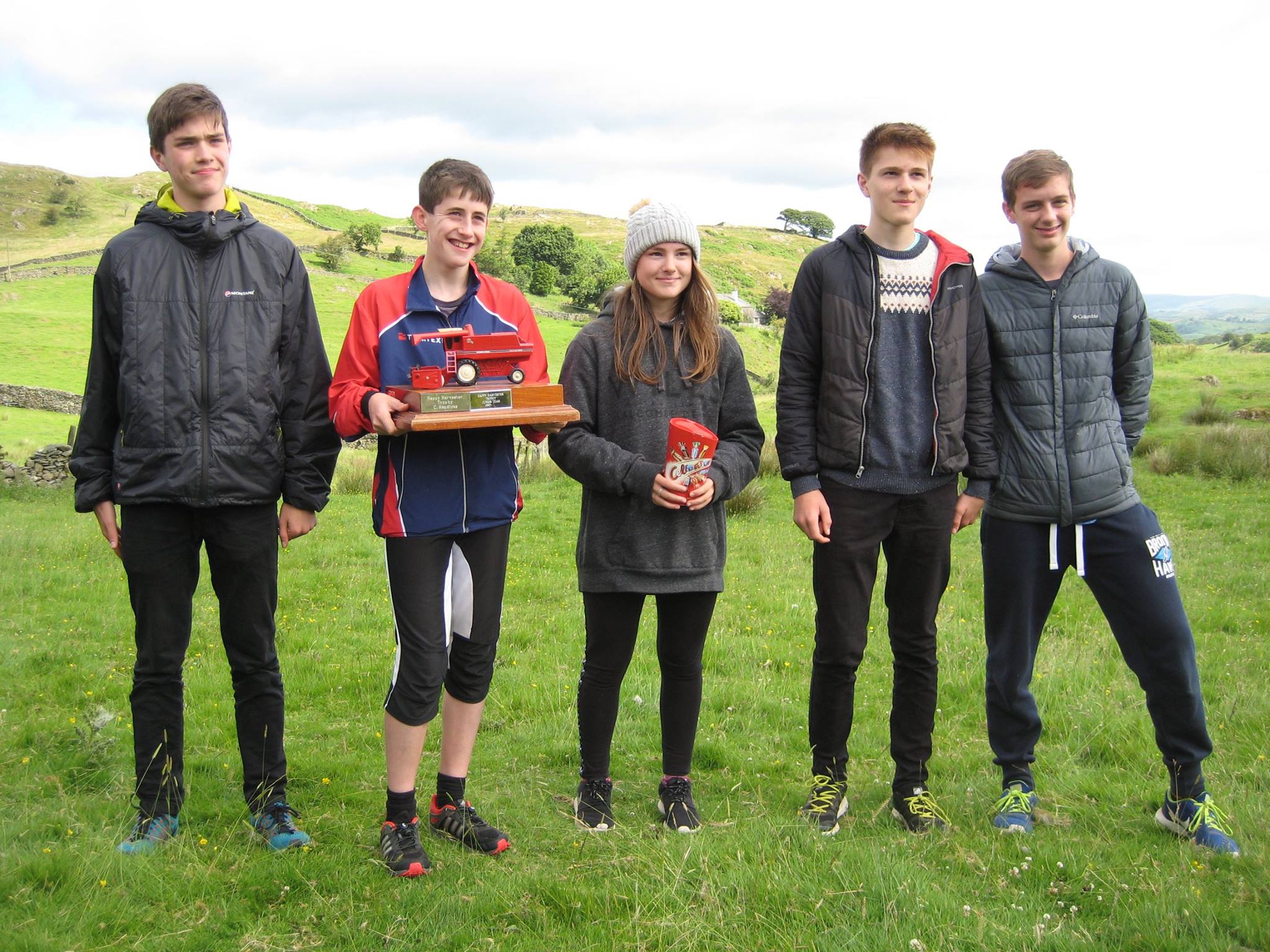
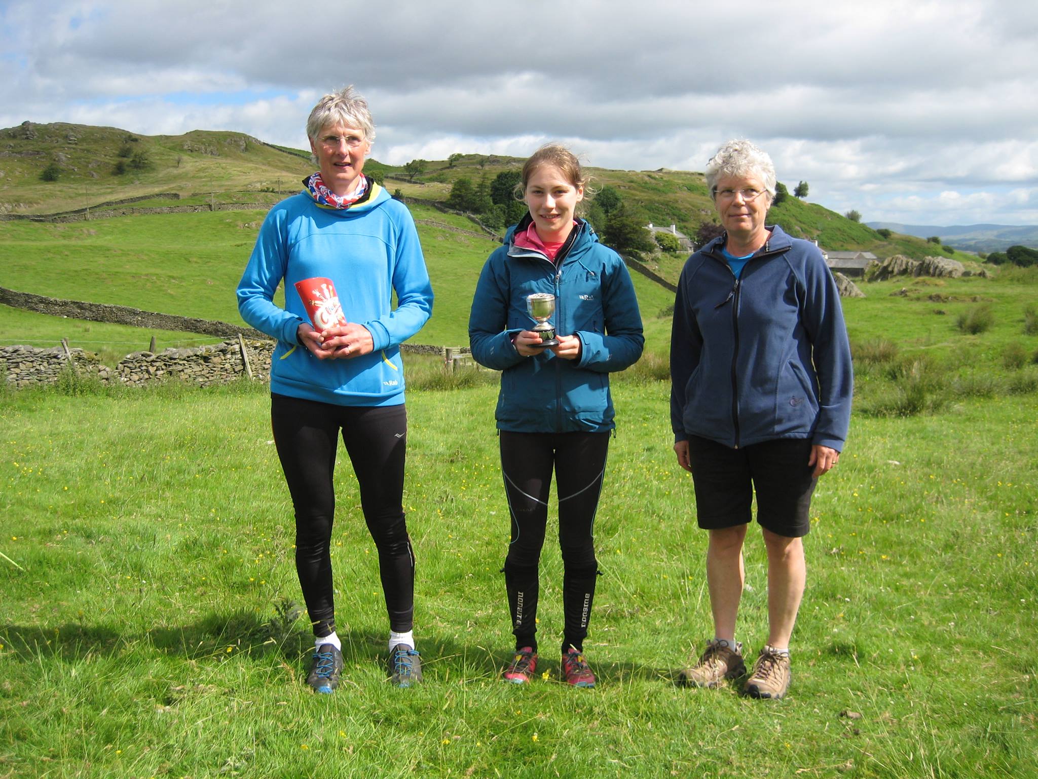
There are trophies for the first team in each class.
GPS tracking
We will have GPS tracking for the leading teams.
Results
- Course results and splits
- Results by category
- Prizewinners
- RouteGadget
- WinSplits
- SplitsBrowser
- GPS tracking replay - a partial (possibly incorrect) record of who is which GPS track is here
Lost property
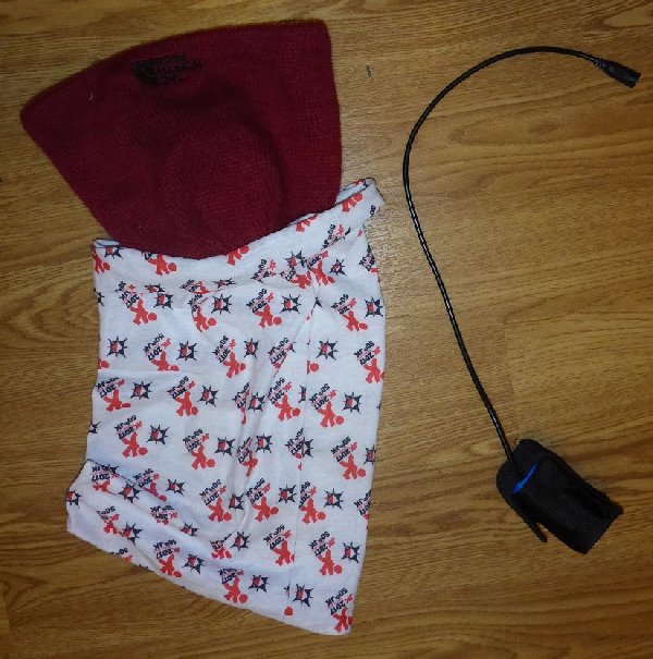
We have the following lost property: a torch battery, a JK 2017 buff and north face hat. Please contact us if you want it returned.
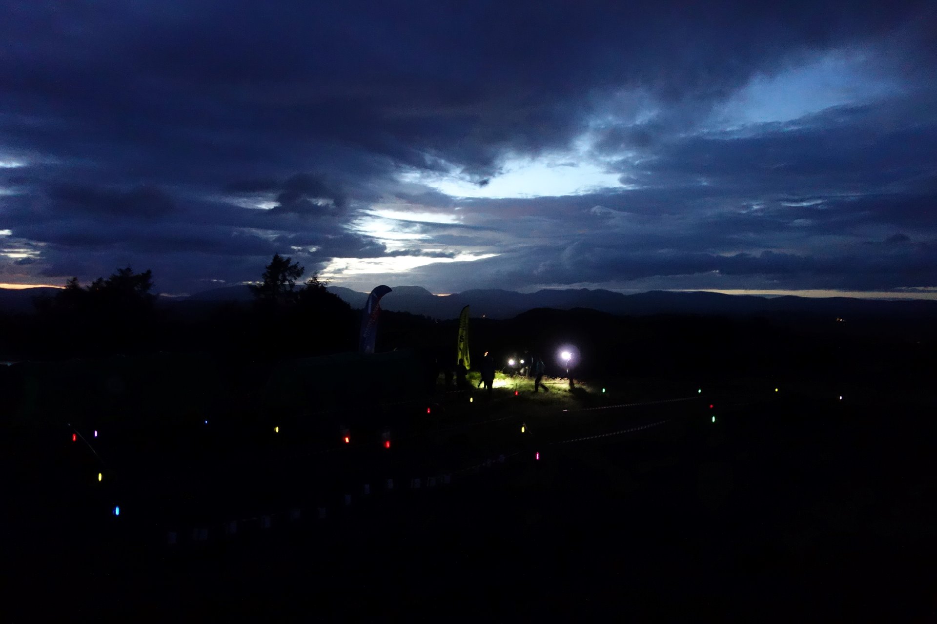
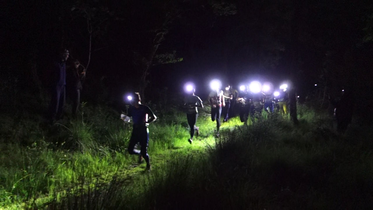
Photos and video

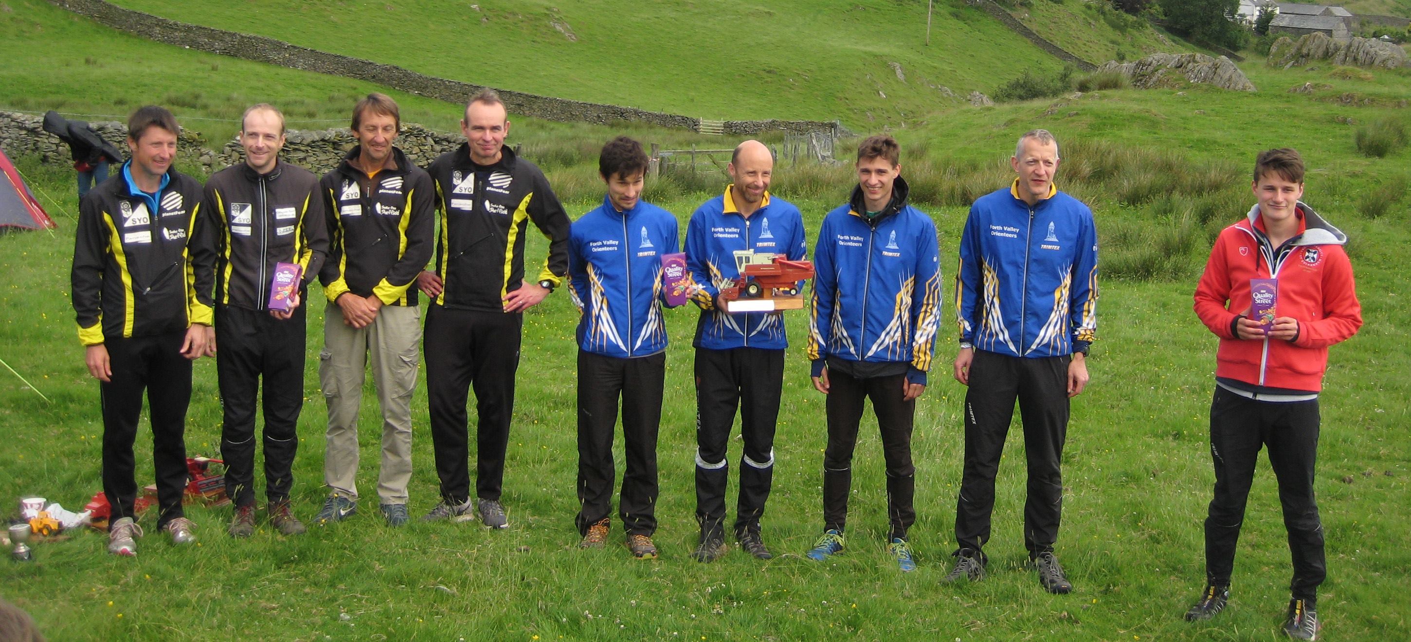
Photos taken by Nick Barrable (daytime ones - except perhaps the ones he's in) and Ben Stevens (nighttime ones)
Final details
Updated 22-June-17Important points
- Whistles compulsory
- Spare torch compulsory until 03:40
- Race number compulsory
- Walls marked with a purple overprint may only be crossed at marked crossing points
- Residents live a few hundred metres east of the camping and we MUST NOT disturb them. Do not stray across the fields in their direction, and, rather sadly, please leave your air horns at home!
- No dogs
- Do not arrive before 18:00
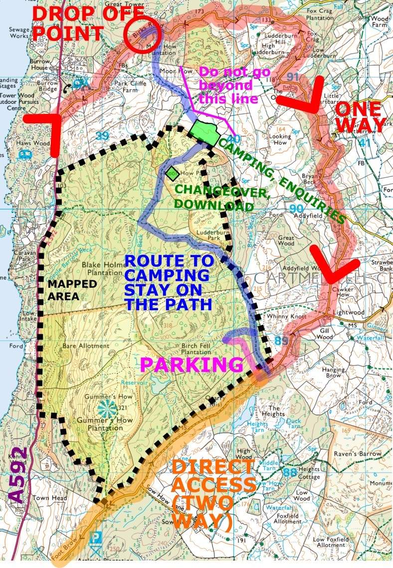
- Parking -> Assembly = 2km. There will be a drop off point available 1km from camping and a one way system. The map on the next page explains all this.
- Do not leave your car in the Great Tower car park overnight, even if you have taken part in the training on Saturday afternoon.
- No water at the camping, bring your own. However, an average of 3.6 biscuits per person will be provided at the finish.
- Parking will not be manned after 10pm. If arriving later, park yourself sensibly and do not block others. If the track becomes full, park in single file along the side of the straight section of road leading west from the parking track.
- Teams should be registered/declared between 19:00 and 23:00
- For course A, note that leg 2 is the long night leg and leg 3 is short night, contrary to what was previously advertised on the website and in the online declaration form.
- Leg 7 on A will have over 30 controls. You cannot use SI version 5 or 8. If this is an issue please contact us.
Arrival (see also map)
Please consider printing a copy of the maps in these details to help you get around! However, routes will be signed and taped with red and white tape for visibility in the day and reflective tape for visibility at night.
As it is 2km from parking to assembly, there will be a drop off point and one-way system in operation, should you wish to drop off your passengers with kit at a closer location 1km from parking.
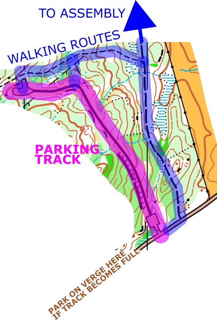
Parking is on a new, well surfaced forest road at the south end of the area. Space will be tight so please share cars where possible. The car park will be manned until 22:00. If arriving later, park yourself sensibly and do not block others. If the track becomes full, park in single file along the side of the straight section of road leading west from the parking track.
There will be a parking charge of £2 per car going direct to the landowner, collected by marshals on arrival. If you arrive after the marshals have left please pay this at enquires, or at the download tent if after 23:00.
North and south
Leave the M6 at junction 36 and follow signs to Newby Bridge (A590). In Newby Bridge, turn right onto the A592. The race will be signed after about 1.3km from the junction at 54.2736, -2.9512 / SD381868. From here, go straight on to reach the drop off point. Turn right to go directly to the car park.
The nearest postcode to drop off is LA23 3PQ (Great Tower, drop off is just west of this)
The nearest postcode to parking is LA11 6NP but parking is a few hundred metres west of this. The parking track itself isn’t yet on the OS map because it is new!
From within the Lake District travelling via Windermere
Follow the A592 south from Windermere. The race will be signed from the turning to Great Tower at 54.3079, -2.9443 / SD386906. From here, turn left to reach the drop off point. Continue straight to go directly to the car park.
Public transport
The nearest station is Windermere (about 6 miles). Doable if you don’t mind a good walk to warm up.
Parking to assembly
This takes you through the competition area on a public footpath. Please stick to the path, and do not use previous maps of the area. This park is rocky and can be very muddy in places. Although it will be signed, please try not to miss the right turn 500m before assembly! During the competition, we ask that you don’t go back to your car if possible, although if you really need to we then will not stop you.
Drop off to camping
This takes you along the road for 100m then across a field then a long a public footpath then across another field. There is long grass (not marshy though) so if it rained recently you may get wet feet. The short road section bends and has low visibility: be aware of traffic. This route passes close to a cottage whose residents must not be disturbed. Please stick to the marked route and try to be quiet. Annoying the residents may jeopardise the race.
All walking routes will be marked by red and white tape (visible in the day) and reflective tape (visible at night as soon as you shine a torch at it). The DrongO bird will also make appearances along the way informing you how much further you have to go.
Timings
- Parking opens 18:00
- Registration opens 19:00
- Sunset 21:50
- Registration closes 23:00
- Course A start 00:00
- Course B start 01:30
- Morning twilight 03:42
- Sunrise 04:37
- Mass start legs 1-6 07:30 (may be postponed if teams are slower than expected)
- Mass start leg 7 08:15 (may be postponed if teams are slower than expected)
- Courses close 11:00
Camping
This is in a grassy field, which is relatively flat by Lake District standards.
There will be no camping payment on the day option. You can add camping to your entry by starting a new entry on Fabian4. Don’t add any teams and just add camping as an extra, and this will allow you to pay for it. This will be available until midnight the night before the race (end of 23rd June).
Campervans cannot be accommodated in the camping field, but can be left at the top of the parking track 2km from assembly. Please contact us if you will be bringing a campervan.
Bin bags will be available for rubbish, but please take it away with you if you can and do not leave anything on the floor.
Map issue
Maps will be sealed and the team and leg number will be visible on the outside. It is the competitor’s responsibility to check that they have the correct map matching their bib number.
Whistles will be checked, and spare torches will be checked until 03:40 when twilight begins. If you do not have these you will not be allowed to start.
Course details
Leg 7 on course A will have over 30 controls. If you have a version 5 or 8 SI card the capacity will be too small. As our hire dibbers will be version 5, please try to source an appropriate dibber from your team, but if this is not possible then contact us on harvester@drongo.org.uk.
All legs are gaffled except for leg 3 of the B relay.
Most legs have three radio controls, except leg 7 of the A relay which has 4, and leg 3 of the B relay which has 1.
The run out to the start kite is approximately 150m from the mass start location, and approximately 250m from the handover on subsequent legs.
Some walls are forbidden to cross and this is clearly marked with purple overprint on the map. These can only be crossed at the marked crossing points. Anything else can be crossed at any point. The main wall running east-west which divides Blakeholme forest in the north from Gummer’s How to the south has controls on the crossing points. Remember to punch these as you pass through the crossing points.
For longer courses which go into the plantation forest in the south-east of the area, there are some ruined fences marked on the map. These are easily passable but in places there are wires at ankle height and head height, so be careful, particularly at night. Eye protection is recommended for this area, particularly at night.
Leg 7 will have a map exchange adjacent to the change over area, providing another spectator opportunity. Leg 7 runners should punch their spectator control and continue to exchange their map. All other runners, and leg 7 runners returning for the second time, should punch the finish then continue to touch the next runner in their team.
All legs will have a short loop at the end around the open moorland near to the changeover area. This is 530-910m long. Leg 7 will have two of these loops: one before the map exchange, and one at the end of the course.
For course A, note that leg 2 is the long night leg and leg 3 is short night, contrary to what was previously advertised on the website and in the online declaration form.
Course A
| Leg | Length (km) | Climb (m) | Controls | Radio controls (%) | TD | Estimated start time | Estimated win time | Light level |
|---|---|---|---|---|---|---|---|---|
| 1 | 6.2-6.5 | 225-285 | 21 | 20,60,80 | 5 | 00:00 | 00:59 | Dark |
| 2 | 7.8-8.2 | 345-380 | 25-26 | 15,65,85 | 5 | 00:59 | 01:14 | Dark |
| 3 | 4.4-4.6 | 175-220 | 13 | 25,40,70 | 5 | 02:13 | 00:41 | Dark |
| 4 | 6.3-6.5 | 245-295 | 21 | 20,60,80 | 5 | 02:54 | 00:55 | Dark |
| 5 | 7.7 | 315-355 | 25-26 | 10,65,85 | 5 | 03:49 | 01:00 | Twilight |
| 6 | 4.1 | 155-185 | 13 | 20,40,70 | 5 | 04:49 | 00:32 | Light |
| 7 | 10.9-11.0 | 435-475 | 36-37 | 10,45,60,80 | 5 | 05:21 | 01:26 | Light |
| Total | 48.1 | 2070 | F: 06:47 | 06:47 |
Course B
| Leg | Length (km) | Climb (m) | Controls | Radio controls (%) | TD | Estimated start time | Estimated win time | Light level |
|---|---|---|---|---|---|---|---|---|
| 1 | 4.9-5.0 | 195-230 | 17 | 20,50,75 | 5 | 01:30 | 00:53 | Dark |
| 2 | 6.9-7.0 | 295-335 | 24 | 15,65,85 | 5 | 02:23 | 01:14 | Dark |
| 3 | 2.9 | 125 | 12 | 40 | 3 | 03:37 | 00:28 | Twilight |
| 4 | 5.2-5.3 | 230-265 | 18 | 20,55,80 | 5 | 04:05 | 00:47 | Light |
| 5 | 7.3-7.5 | 340-350 | 25 | 15,65,80 | 5 | 04:52 | 01:07 | Light |
| Total | 27.4 | 1250 | F: 05:59 | 04:29 |
Start, changeover, download, results
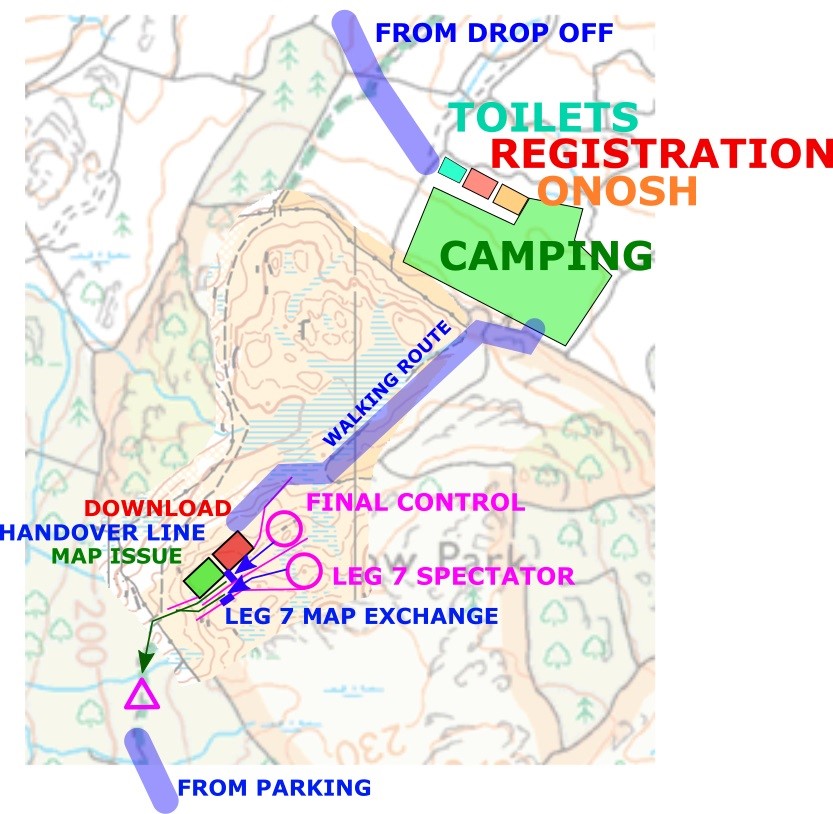
The mass start location will be just inside the woods adjacent to assembly.
Changeover will be 400m from camping, in an open area just outside the wood with spectacular views (when it's light!). The layout for this area is shown on the arena map.
When you finish, punch the finish, then touch your next runner. Next go straight to download, and hand in your map, and your SI card if hired. Maps will be available for collection after the leg 7 mini mass start.
For the final lap, the first runner to cross the line wins, not the first to punch the finish box. If it is a sprint finish, run for the line and not the finish box!
Live results will be displayed in the download tent, as well as radio control updates and GPS tracking. Live results will also be posted to the DrongO website at regular intervals signal permitting.
A WiFi network will be available through which you can view live results on your own device (no internet access). Details of how to connect will be on a sign in the download tent.
Registration (open 19:00-23:00)
Online team declarations are open until midnight on Thursday 22nd June. Please declare your teams online if you possibly can.
Hire dibbers (version 5) will be available for £1 per person. This is payable in cash upon collection.
Registration is in the camping field. It will be open for team declarations between 19:00-23:00 on Saturday evening. After 23:00, it will become combined with download in the download tent, 400m from the camping.
Team captains should collect an envelope from registration which will contain:
- Race numbers
- Safety pins
- Declaration forms
- Hire dibbers
Teams declared online will have pre-printed forms and you will need to check and return the form with any changes that you may have to your teams. Teams which have not declared online will need to fill in the form from scratch on the day. Please return your declarations by 23:00, after this time you will have to return your form directly to the download tent instead.
You should also return any trophies from previous years to registration during this time.
Electronic punching
SportIdent will be used. SI Air will not be enabled. It is the competitors’ responsibility to ensure that they have punched. If a control does not flash or appears to be broken, punch your map using the backup pin punch provided.
Map and terrain
The map is 1:10000, 5m contour interval, A4.
It is forbidden to use previous maps of the area once you have arrived at assembly/camping, or along any of the walking routes to get there.
The map is excellent quality, mapped and updated by Martin Bagness for the Northern Championships in 2013, with minor updates for this race. A brand new section of open moorland near the changeover area has also been added specially for this race.
The terrain is mixed, with the northern section being largely beautiful runnable woodland. The southern section is open moorland, of which sections are beginning to become bracken at this time of year. Courses are planned to make use of the best parts of the area. The final loop of courses will take runners out onto the small, newly mapped, moorland area before the finish.
GPS Tracking
The top 5 seeded teams in the Men’s Premier and Women’s Premier categories will carry GPS trackers on first leg. After this the leading five teams will carry them. Signal is variable so at times tracking will be poor, but at times will make for exciting spectating. Tracking will be displayed in the download tent alongside results. Trackers will be given to you at map issue: please ensure you allow an extra couple of minutes to get set up if you are being tracked.
Facilities
Four portaloos and a urinal will be available in the camping field.
ONosh will be available in the camping field on Saturday evening and Sunday morning. Unfortunately due to permissions we could not accommodate an orienteering shop.
Prizegiving
This will be held as soon as possible once the first three teams in Men’s and Women’s premier have completed their course, and the winner of other classes. Very roughly this could be at around 8-9am. A verbal warning will be given in the camping field before the prizegiving.
Trophies will be awarded to the winners of each class in the table below, in addition there will be a small shareable prize for 2nd and 3rd placed teams on Men’s and Women’s premier.
| Class | Course | Entry restrictions |
|---|---|---|
| Men's Premier | A | None |
| A Handicap | A | At most 49 handicap points |
| Women's Premier | B | All women |
| Junior | B | M/W20 or under |
| Women's Handicap | B | At most 26 handicap points, all women |
| B Handicap | B | At most 26 handicap points |
| Small Club | A | Not BOK, DEE, FVO, LOC, NOC, SLOW, SYO |
A Small Club is a club which has not finished in the top 3 on the A course in the last 5 years.
In the event of a team winning more than one class, the trophies will be awarded in the following order, to different teams.
- Course A - Men’s Premier, A Handicap, Small Club
- Course B - Women’s Premier, Junior, Women’s Handicap, B Handicap
Each age class is given a hanicap points value as follows.
| Class | 10 | 12 | 14 | 16 | 18 | 20 | 21 | 35 | 40 | 45 | 50 | 55 | 60 | 65+ |
|---|---|---|---|---|---|---|---|---|---|---|---|---|---|---|
| Men | 1 | 2 | 4 | 6 | 8 | 9 | 10 | 9 | 8 | 7 | 6 | 5 | 4 | 3 |
| Women | 1 | 2 | 3 | 4 | 5 | 6 | 7 | 6 | 5 | 4 | 3 | 2 | 1 | 0 |
See the British Orienteering Harvester competition rules for further information on eligibility etc.
Kit carrying service
To help any less able people, we will be offering to manually carry a small amount of kit between the drop off point and the camping field. Please only drop kit here if you really can’t carry it yourself. The kit drop point will be just after the start of the route from drop off to camping, where the route leaves the road. There will be an unsupervised area (kit is left at your own risk) to leave kit. If you leave kit there before 20:00, it will be left outside the registration tent by 21:00. In the morning, kit left outside the registration tent before 08:30 will be carried down to the drop off point by 09:30. If you drop your kit later than these times, no service will be available.
Emergencies and Safety
A first aider will be on duty throughout the night. Contact the download tent who will be able to point you to them.
Whistles are compulsory, and a spare torch is compulsory until 03:40 when twilight begins. In the event of bad weather, waterproof coats will be made compulsory to carry. These should have taped seams and a hood. Full leg and torso cover is required (bare arms are ok). These items will be checked at map issue.
If you have a pre-existing medical condition which you feel could be relevant to help our first aiders, please notify the organiser in confidence before the race by emailing harvester@drongo.org.uk.
Members of the public may use the public footpaths running through the area, please be courteous if you do see anybody.
You may come across cattle grazing in the area during your course.
Car keys can be left at registration, or download after registration closes at 23:00. Keys should be collected from the download tent in the morning.
The organiser can be telephoned on 07975 845569.
The nearest A&E hospital is 32 minutes away from the car park and is Furness General Hospital, Dalton Lane, Barrow in Furness, Cumbria, LA14 4LF. A map will be available at download.
Thank you
- To the farmer, Derek, for letting us use his land for camping and changeover and for being very helpful.
- To David Jackson at the Sir John Fisher Foundation for allowing us to use Blakeholme.
- To Tilhill Forestry for allowing us to use Birch Hill and Gummers How, including the car parking track.
- To SROC for allowing us to use their map and lending us tents, tables, and a generator.
- To LOC, in particular Richard Tiley and Derek Allison, for all their local knowledge helping to sort out permissions. This was not an easy task!
- To WCOC for lending us their kites, stakes and SI boxes
- To SLOW for letting us hire out their dibbers
- To WAOC for lending us another tent and some more tables
- To CUOC for lending us loads of other things
- To all the DrongO, CUOC, LUOC and UBOC members who have volunteered to help at the race.
Officials
- Organiser - Ben Windsor, DrongO, email harvester@drongo.org.uk (preferred), phone 07975 845569
- Planner - Matthew Vokes, DrongO
- Controller - Derek Allison, LOC
- Assistant controller - Brian Jackson, SROC
Blurb
Orienteering is an adventure sport and you take part at your own risk and are responsible for your own safety. DrongO take no responsibility for any injuries or losses incurred. In the event of cancellation we may retain all or part of your entry fee to cover non-recoverable costs. In the unlikely event of cancellation, it will be posted on the website and emails sent to all team captains.
Entry details
Entries are now open through Fabian4.
You should enter either course A or course B, and we have also requested on the entry form that you enter the class(es) from the table above that you intend to be eligible for in the special request box. The information collected is displayed on the entry list so you can see who you're competing against! See the 'Prizegiving' section above for class eligibility details.
Entry fees
| Enter by date | Course A teams | Course B teams | Course A junior or student teams | Course B junior or student teams |
|---|---|---|---|---|
| End of 21-May-17 | £56 | £40 | £26 | £20 |
| End of 11-Jun-17 | £70 | £50 | £40 | £30 |
| End of 18-Jun-17 | £84 | £60 | £54 | £40 |
| SportIdent card hire (electronic chip timing) | £1 per person | |||
Teams count as junior or student teams if they have more than half junior or student runners.
Camping is not included in the entry and costs £9 (£6 junior/student) per person for the night.
Team declarations
Team declarations will open on 13 June via Fabian4, and will close at midnight on Thursday 22 June.
Saturday training
When and where
Saturday 24 June, 2pm - 5pm. Do not arrive before 2pm.
Great Tower Wood, LA23 3PQ, Lake District. This is within a few hundred meters of the drop-off point for the Harvester camping.
Entries
Cost: £4/person (£3 for land access, £1 for map royalties and printing)
Entry limit: 100 (first come, first served)
Enter by ordering maps at the same time as entering the Harvester via Fabian 4 (there is an option on the entry form). This is to ensure we adhere to the strict limit of 100 entrants. Teams that entered before this option was available should create a new entry without entering any teams again.
Details
We will be offering a simple and informal open training session at Great Tower to allow competitors to stretch their legs in some technical terrain ahead of the Harvester Relays.
A single course with loops part way round will be available of total length of around 3.5km / 230m climb, but possible to cut down to ~2.0km if the loops are missed out. We will have a handful of spare blank maps if you want to go further! You must sign in and out as you head off for your training. No official timing will be carried out.
Please car share as parking will be tight - no single drivers please! Please do not arrive before 2pm, controls will be collected in from 5pm.
Officials' comments
Organiser's comments
The idea of us organising the Harvester started a couple of years ago, and we volunteered for it this time last year. We've had teams at the Harvester for several years, and since DrongO has members distributed across the country it doesn't really have its own areas or its own events, so the Harvester was a good one to do because it doesn't really belong to a club. The Lake District is one of the best places in the country, Matthew lived there and was willing to plan, and the Harvester hadn't been in the north for a long time. So it was that the ambitious plan began.
The organisation got started well in advance, but permissions turned out to be very tricky! Dave Hargreaves of SROC and Richard Tiley of LOC were helpful at getting things started and we had permission to run in Blakeholme early on - now just a campsite and a car park to go! Derek Allison then went way beyond what a controller is required to do and helped us get our final permissions, as Richard was already doing a lot for the three other major events being held in the Lakes this year! Our plans to park and camp at Great Tower didn't work out due to children being on site there, our plans to camp at Park Cliffe didn't work out because of the high cost, and our plans to camp in the fields in the south near to the car park didn't work out the owner didn't want us to. However, a very helpful and friendly farmer called Derek allowed us to use his fields for camping and assembly, as long as we didn't disturb the nearby residents. Vehicle access was minimal to his field though, along a narrow and uneven track and passing right by the cottages which we were trying not to disturb. Parking only at Great Tower without the camping also was unsuccessful, so the next option was the forest track at the south of the area. These were only confirmed about a month before the race, so Matthew had to plan in a very short time period since we didn't know where the start would be until then! We also asked Martin Bagness to extend the map to include the assembly field, which he did within a week of being asked!
The layout was far from ideal, with everybody having to walk at least 1km with their tents even if they used the drop off point. I tried to make the walks a little bit more exciting with fun facts about DrongO written on the direction signs, but lots of people said they didn't notice them until they were almost there!
Everything on the day seemed to go to plan - the main issue I saw (which really wasn't too bad) was that the GPS tracking didn't work: we had checked that there was phone signal at assembly, but hadn't actually taken a laptop up there and tried to load a webpage! It turns out the internet was good enough to keep the radio controls functioning but not for GPS.
Helpers were looking slightly tight but we had enough in the end, as a small club without our members in one place it was good to see so many people from around the country joining in. A few members from CUOC, LUOC and UBOC also stepped in to help and this made the numbers up. Thanks for staying enthusiastic about taping and signing 3.5km worth of walking route, and over 12km of road for the one way system.
There are a lot of people to thank for their help: Derek A (LOC), Richard T (LOC) and Dave H (SROC) for their help with permissions, Derek A and Brian J (SROC) for their joint controlling, Matthew V for his short timescale planning, John O (DrongO) for buying equipment so making it one less task for me to worry about, Ben S (DrongO) for lots of organisational advice and for making an excellent website, and SROC, WAOC, SLOW, CUOC and WCOC, all of whom lent us some sort of equipment! That makes contributions from 8 clubs in total!
After a lot of emails and logistics, everything worked out, the event budget broke even, and we received lots of positive comments, so I am satisfied!
Planner's comments
I hope everyone enjoyed the courses set for you. Sitting at the finish most of the night, I think the general summary could be summed up as “Tough, but great”, which I’m pretty pleased with! Considering the short timescales that I had to plan this (which Ben, Derek & Brian have covered in their comments), I was really happy with the way things turned out.
I do make no apologies for the fact it was tough – technically at least that was certainly the intention. I wanted to throw the A course straight in at the deep end, hence the long leg cross-downhill into the complex rocks, which, from the tracking, the radio control data and the comments of “chaos” at the finish of first leg, certainly seems to have worked! I will (slightly) apologies for the lengths of the course, but I did use the recent NWWL event & Northern Championships as a guide for min/km for night / day respectivly. Perhaps I shouldn’t have used the winners time for this, or maybe it was just that people just made far more mistakes than I was expecting…
The growth of the bracken in the last two weeks probably didn’t help either – the difference between when I had taped the control sites just two weeks prior to the event and on the day was significant – I did my best to tend to it around some of the control sites, but I might have needed to do a little bit more around others – sorry to those who didn’t spot controls obscured in the bracken (53 right at the end I believe caused some trouble) – that wasn’t my intention. Had this event been held in early May when I made my first visit, the forest and open would have been absolutely wonderful! But then there would have been more darkness, and the winning time would have probably been even further out…
I have two reputations, that this event has done nothing but strengthen:
Many thanks to Derek & Brian for their very helpful controlling, to Derek & Richard for sorting out the permissions, and to Ben for organising everything leaving me able to concentrate getting the courses done. I think I need a break now, but I’m sure DrongO will be back soon with another event – hope to see you all there.
Controller's comments
I feel I should apologise for the courses being too long at the weekend; although I do feel that there are some mitigating circumstances if anyone is interested this is a summary of the saga!
I agreed to control the event early in March with the proviso that I’d not be available to be there on the day; it was my 60th ‘celebration’ weekend; fortunately Brian Jackson agreed to do the on the day controlling. I was keen to help as it’s so rare to attend an event with officials under 50! At that time, Richard Tiley, BOC Coordinator; had already arranged permissions for the terrain and outline ideas for the camping and car parking at Great Tower scout camp. As he was very busy with BOC; I agreed to follow up these outstanding issues.
Over the following 11 weeks; I made 15 visits to the area, speaking to 4 different farmers and land owners. The ‘must avoid’ cottage created an obstruction that caused a few issues. Our favoured, northern option of parking at Great Tower was only rejected by the scouts 5 weeks later, they didn’t want any coming and going in the middle of the night. We then pursued a southern combined camping and parking field off Sow How Lane, which initially was a good possibility but the need for appropriate fields for the new born cattle put paid to that so we then went onto the Whinny Knott camping with parking in Simpson Ground. Once again the cattle took priority. Tilhill then announced that the felling of the plantation, to the SW of where the courses eventually went; may start before the event weekend.
I then, with 5 weeks to go to the event; although it was ‘spread out and certainly not ideal; I ‘started’ on the eventual arrangements. I sent an email to Ben, once the entries had opened; saying that if this didn’t work; I’d exhausted all the possibilities and we’d have to cancel. Derek Smith, my ‘3rd farmer’, was extremely helpful and made it clear that he wanted to help me make the event happen. The National Trust agreed for us to cross their land, Tilhill were happy to allow us parking providing we paid a fee and for any ‘wheel spin damage’ and Derek agreed that we could camp on his field. We now knew where the start and finish was going to be so 4 weeks before the event Matthew was given the go ahead to plan his courses with some sort of certainty. He asked if we could map the open area, rather than just having the finish/assembly off the map; Derek gave permission, Bilbo mapped it and it was added.
We had previously held a NW Night League event with 10 minute km, M 50 winning times, Bilbo and Quentin so I thought some younger legs may be quicker; so didn’t shorten Matthew’s courses.
I received Matthew’s first draft of courses, after I’d set off for the LAMM on the 3rd June so couldn’t look until I got back, 19 days before the event. My computer took more than 4 hours exporting all the ‘OCAD gaffles’ so I asked Matthew to simplify things and made a few suggestions for changes to the courses, but basically asked him to prepare some final courses using the controls he’d identified. He taped them on the Sunday; I checked the control sites on the Monday (the day BML print asked for the final courses); fortunately; I considered all but 4 were fair sites. The bracken and grass had grown a lot in the previous 2 weeks and we still had almost another 2 weeks to go.
Matthew changed those, cut the circles and lines over the next 4 days and sent the final files simultaneously to BML and I just 8 days prior to the event, but it was really too late for me to change anything without an increased risk of making mistakes. So I went with it.
I then told Brian to focus on the 4 controls that I’d not been happy with and blame everything on me!
Working with young enthusiastic competent people is great; Ben and Matthew deserve great credit for providing a great event; I look forward to another event that they are involved with sometime in the future.
Assistant controller's comments
What a fine and memorable event that was! Being an "on the day controller" was a new and unusual role.
I met the DrongO organising team for the first time at lunchtime on the day of the event in the Crown at Higher Newton, a place that brought back traumatic orienteering memories for me. That was some years ago on a night before an event on Simpson Ground where I was the planner, I had popped in for a bite to eat and a group of real ale enthusiasts who were on the pub crawl by minibus came into the pub. I knew one of them and after a pint and a bit of banter they went on their way. When it was my time to leave I discovered that my jacket with my car keys in pocket was no longer there. Cold sweat; Loads of SI kit and kites etc. needed for the next day were still in the car. I was stranded 50 miles from home. After an anxious 20 mins or so the ale connoisseurs returned. An absent minded member of the group had taken my jacket by mistake and was surprised to find the the keys. Panic over, event saved. The Harvester could hold no such horrors, I thought.
The way that you were seated at a long table and against the far wall of an otherwise empty dining room made me think at first that I had come to a re-enactment of the Last Supper. About 6 hours later when checking controls, and still at the south end of the map I began to think that I had had my last supper and might never enjoy another one. Derek had told me that he was worried that the bracken might have grown in the last couple of weeks. He was right. In places it was head high and made what is quite physical terrain totally draining. If I had been the same age as those DrongOs I might not have had to cut the control checking short. However, everything I had seen made me confident so I returned to the Start and Finish tents and satisfied myself that all was well with the layout and the final loop, and it was. I was confident all would be well, the Harvester was in good hands and my main concern would be fielding complaints from competitors and what I should say to them. I practiced for this in the evening when competitors asked me what the bracken was like and I answered them with a silent inane smile.
My contribution to the event was just the time I spent on the day and being party to many of the emails that flowed between Ben, Matthew and Derek Allison (the real Controller) in the weeks beforehand. Derek must be thanked for greatly exceeding his brief and working as Ben and Matthew's local agent, sorting out further permissions needed for the extension of the competition area, the parking, camping and Start/Finish. As an SROC member I know how difficult the logistics of these elements are at Blakeholme. This troika of officials managed to get all these elements in place magnificently, even if it involved some long walks for competitors.
The main joy of the event and the cause of my exhaustion was working with an organising team who were not only so young but so energetic too. I am nearly 50 years older than most of them. Matthew reckoned he covered about 30km putting out controls etc. BOF guidelines on course planning should have alerted me as to what I was in for. These say that I should do 39% of an M21 distance and assume that I go at 57% his speed. Furthermore, they cheerfully point out that rougher terrain has a bigger effect on older competitors who also find dense tree growth (and bracken?) more of an obstacle. Well that's my excuse, but Matthew was amazing. After all his exhausting planner's work in the forest he was still presiding over the results display screens at 3.15am when I went to bed. He was like an orienteering Murray Walker enthusiastically commentating on how everyone was doing and predicting who would be next at the 3 radio controls. I suspect he was still doing this when the winners came in 4 or 5 hours later.
Competitors found it tough but seemed to have relished the challenge, even those who were out for a very long time. Night orienteering experts managed to put in times that were not much slower than predicted. The prizegiving was on time and fun with all those childhood toys to own for a year, and many thanks for presenting me with a memento of a bottle port. I always knew that Cambridge University students spend all their time drinking sherry and I am grateful for being able to maintain the stereotype.
Harvester aficionados owe the DrongOs a very big thank you for putting on this year's event. I look forward to seeing them put on another spectacular on in the near future. So just ask clubs to lend you an area, a map and a bit of kit and they too can have a pop-up event in their areas.
Congratulations on organising a top event.
Biscuit buyer's comments
The biscuit buying process began with just a couple of weeks to go before the race. I was honoured to be tasked with this prestigious role of making sure that biscuit would be available at the finish. I didn't want anybody to feel short changed of biscuits, nor did I want anybody to feel that they had been forgotten about due to their favourite biscuit not being available. I decided that between three and four biscuits per runner should be purchased. It was a tough slog to get from my house to Aldi with the westerlies a blowin', but fortunately I had been there before so I knew the way. I had a good brew when I got back and even resisted the temptation to complement it with a sneaky biscuit. I reckoned 222 people would be at the race (although it was actually fewer in the end) so at 3.378 biscuits per runner on average, I thought this was a job well done.
Interestingly, my post-race analysis of competior's biscuit eating preferences shows that Rich Tea were the least popular; these were also the cheapest biscuit. Interestingly however, Malted Milks were the second most expensive per biscuit, yet had not been demolished by the end of the race. The chocolate digestives and bourbons were the first to go, with custard creams shortly behind, and just a few ginger nuts left by the time the last runner returned. So my ratios of biscuit types weren't quite correct but hey, that's the way the cookie crumbles.
I'd like to thank Ben for giving me the cracking job of buying these biscuits, and I look forward to further biscuit acquisition work in the future.